Double Clicking a graphic will usually render it full sized. Then use the back arrow on your browser to return to the blog.
Trail Notes: No construction on the trail. The trail section adjacent to Highway 58 is entirely complete. Normal maintenance is a regular activity (mowing, patching etc.) At two points the trail still spills onto streets. One, only about 250 yards long in a neighborhood and the other about a mile long to access a secondary trail in order to get under Kipling street.
Misc Info: Expect to encounter horses and lamas in the Wheat Ridge area.
Trail Tale: On almost every ride something interesting happens. Only a few miles into this ride I came upon an older man (older than me) who was leaning against his bike with his head down. I stopped and inquired about his condition. He said his shoulder hurt and he didn't know why. Upon examination, his arm (of the sore shoulder side) was all scraped up and bleeding. I got him off the trail and administered first aid. He had undoubtedly fallen but did not remember it. He would not permit me to call paramedics or relatives. He was wearing a helmet and appeared to be otherwise OK. Soon, he was on his way and so was I.
 I started on the Platte River Trail at 70th Street and the river. Riding 2 tenths of a mile south brings you to the Clear Creek trail head. At mile 1.3 you come to the first of 11 overpasses which include 2 normal roads, 3 major freeways and miscellaneous on ramps, flyovers, etc.
 At the end of another mile you come out of the underpasses and reach Twin Lakes (where I usually start my Clear Creek Rides)
 The spring runoff is underway and Clear Creek is running much fuller than usual. Some of the underpasses are closed due to high water and so street level crossings are sometimes necessary.

Here is a video of what the creek looks like at about mile 5.
Most of the ride is very pleasant. As the trees and bushes fill out they screen off many of the offending sights and sounds (freeways and junkyards and the like). Here is what the trail looks like at mile 8.

At mile 13 the trail exits onto streets in order to access a trail that goes under Kipling Street. I usually take this opportunity to visit my favorite health food establishment, Winchell's Donuts. I scored a chocolate covered cruller and a custard filled round thingy. My diabetes thanks me for the glucose.
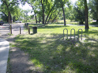 Just west of Wadsworth the trail pass a small isolated park that is had to find from the road and thus is not overrun with people. The area has some mature trees and is quite nice. Mature trees are uncommon on today's Clear Creek. Most were cut down by the gold rushers for fuel, sluices, and shelters.
 This section is very popular for obvious reasons.
And, as mentioned earlier, a popular area for horseback riding.

 At mile 14.5 the trail passes under I70 and heads to Golden on a course parallel to highway 58. Much of this portion of the trail has been relocated and is new. The lush trees are left behind and the flora more grassy.
 The trail begins some serious climbing and in about 3 miles tops out where I took this picture.
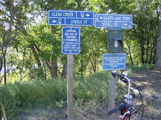
 Then it is downhill into Golden. The trail reaches Washington Street where this sign greets you.
Now, I turn the trike around and do it all again, seeing all of the green from the other direction. It was a great ride in both directions. I end this with a couple of pictures for those of you who might have wondered how I get my trike from place to place to make all these great rides.


 The railroad crossing is immediately followed by two the five cattle guards installed on the trail. As you can see from the picture, there are narrow areas made for dogs and bikes to cross but are too narrow for trikes. I usually walk the trike across these because riding across at any speed breaks spokes on my wheels.
 There is also a popular dog training area in this section of the trail.


 The Poudre Learing Center is at about mile 9. Besides the buildings, the center stretches over many acres where groups are taken around the area and introduced to the flora and fona of the region by the trained staff. It seems to be a popular destination.


