Thursday, May 07, 2009

Poudre River Trail


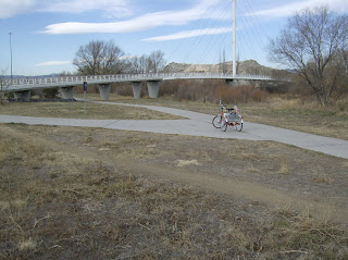
Quick Ride Summary: May 6th, 2009. 40.35miles round trip. Elevation change 200 feet each direction. For a 20 mile trail, that is virtually flat. Weather sunny, temp. mid 70's, wind 10-12mph from the west and then the southwest. Trail surface is smooth concrete; much of it brand new.


The trail travels through extremes. In some portions you are isolated and riding through remote ranch lands and in others you are riding on the sidewalks of subdivisions.

The website for the Poudre River Trail may be accessed by clicking the title of this article. The trail website indicates that the trail is still under construction, but that is no longer true. The trail is complete.
As usual, pictures may be double-clicked to see larger copies.
(Editor's note: Actually I tested this feature and found that not all pictures could be expanded. It appears to be because I added some of the pictures in groups rather than individually and this disabled the links. I won't make that mistake in the future)


I started on the east end of the trail in Greeley, Colorado at the Island Grove Regional Park. The park is located at 11th and D streets in Greeley. With some exceptions, the trail follows the Cache La Poudre River, a primary source of water for the ranches, farms and cities of northern Colorado.


The first mile or so, the trail and river move through an industrial area on the south bank. Many trail users avoid this section by parking at one of the upstream access points.


At mile 2 the trail moves through a series of lakes. Most have been created by sand and gravel operations which continue at various points along the river creating sites for future lakes.

At mile 4.2 is a railroad crossing. Although trains are not frequent, this is not a spur or siding.


The railroad crossing is immediately followed by two the five cattle guards installed on the trail. As you can see from the picture, there are narrow areas made for dogs and bikes to cross but are too narrow for trikes. I usually walk the trike across these because riding across at any speed breaks spokes on my wheels.


Cell service is very good in this area. This rancher has obviously upgraded from his travel trailer to a motor home with the proceeds from the Cell Tower in his yard.


There is also a popular dog training area in this section of the trail.


The further west you travel the larger the river gets. Even with spring runoff, much of the water is siphoned off for irrigation and other water needs all along its length.


Mile 7.2 brings a welcome sight. A toilet.


These northern Colorado trails also have another amenity that I have not found anywhere else. Solar powered air stations. You push a button and the compressor comes to life and you can air up a soft tire, etc. Very Nice! One thing that is not found for long stretches of the trail is water. So bring plenty to drink.


Mile 8 brings warnings of poison ivy and also areas of falling rock. This is an area with residential developments to the south, but still very picturesque.


The Poudre Learing Center is at about mile 9. Besides the buildings, the center stretches over many acres where groups are taken around the area and introduced to the flora and fona of the region by the trained staff. It seems to be a popular destination.


This portion is in ranch country and the trail cuts through the middle of the Orr Ranch. Riding through the ranch I came across a young cow that had managed to get out ot the ranchland and onto the trail and was desperately trying to get back into the fields. I called the ranch management folks and they sent a cowboy to return the cow to the herd; I rode on.


Miles 11 through about 13 pass through and along the edge of land owned by the Eastman Kodak Company. They have several large facilities that cover most of a mile and are major contributors of parks and trails in the Windsor area. During this section of the ride I came across a small snake crossing the trail. I mention this because I do not like snakes and tend to measure all rides in the number of snake sightings. This was only a One Snake Ride.


At mile 15 the trail leaves the river (a golf course is in the way) and goes through Windsor residential neighborhoods. These neighborhoods are all around lakes. The area is called Pelican Lakes and may pelicans were on the water and in the air.


Mile 16.25 brings you to the Eastman Pavillion, a park, playground and picnic facility where I usually take a break. Restrooms, water and electricity are among the amenities. I will have my lunch here on the way back.


At about mile 17.5 the trail passes though an active mining operation and the trail is appropriately signed.

This is followed by more lakes and some medium to upscale neighborhoods.
Finally the trail becames rural again and at mile 20.35 the trail deadends into a fence. Perched on top of one of the fence posts is a wooden owl.
It is the tradition of the Poudre River Trail to pat the owl on the head before turning around and heading back down the trail. I did so, and then rode the 20+ miles in the reverse order.


Friday, May 01, 2009

Barr Lake: The Good, The Bad, and The Ugly

Quick Ride Summary: Date - April, 30 2009. Nine miles around the lake. Elevation change near zero. Weather sunny, temp. 60, wind 4-6mph from the west. Trail surface included gravel, dirt, mud, ruts, and other.

As always, double-clicking a picture will render it full sized in your browser.

This morning I did a 15 mile training ride and thought that since I had never done the Barr Lake ride it would make a nice afternoon outing and an interesting write-up for this blog.

I parked at the Barr State Park Nature Center at about 2:00p.m., unloaded and began the circuit of the lake in a clockwise direction. The trail was crushed rock but not particularly well maintained. In the first mile or so there were very nice blinds for watching wildlife, Boardwalks out into the wetlands and the lake (one with a gazebo).


At about mile two I saw a sizable snake crossing the trail (my first of the season). He was 6 or seven feet long and not quite as big around as my forearm. I was glad to put him behind me. A little further along I saw a herd of Mule Deer. Some were lying down and some walking around. You can tell by their ears why they are called Mule Deer.

There was an abundance of waterfowl; ducks, geese, blue herons and others I didn't know the names of. I didn't take any pictures of them.

At about mile 2.5 the trail began to deteriorate to dirt and sand ruts. That might be OK for a bike but is a disaster for a trike. The ranger had told me the trail was crushed gravel so I thought this was a temporary problem.

WRONG! The condition of the trail continued to deteriorate and at one point actually ran along the railroad track easement. It was so rough that one of my fender broke loose from its mounting and I had to use electrical tape to re-afix it temporarily. So on the west side of the lake the view is mostly of a giant concrete slag heap, the railroad, some cattle, and other uninteresting stuff.

Once I crossed the dam and re-entered the actual state park property the trail again became crushed rock, but I was long passed being interested in anything except getting off that damned trail.

I do not recommend this ride, even for mountain bikes as at least 5 miles of it are just plain ugly.

Wednesday, April 29, 2009

Pike's Peak Greenway

Quick Ride Summary: 26.53 miles round trip. Elevation change 400 feet each direction. Weather sunny, temp. mid 60's, wind 6-8mph from the south. Trail surface included beautiful new concrete, just plain dirt, and everything in between. Website for the Pike's Peak Greenway may be accessed by clicking HERE.

Pictures may be double-clicked to see larger copies.

Started for Colorado Springs at 7:30a.m. Objective is to learn the core of the trail for later exploration of connecting trails (and, of course, to have a good time). I needed a trail map so I started at Criterium Bicycles. They not only have most everything you need they are also a trail head. They sold me a map and I unloaded the trike and used them as my trail head.

I asked the young man helping me with the map, Which way is uphill and which way is downhill. He said, "I don't know. It's pretty much flat." I didn't know it then, but one should not ask someone in such good physical condition which way is uphill because he is so strong that he never noticed that one way might be somewhat more difficult than the other. Well, I later noticed...

9:30a.m.: I headed south on the trail and found that I was coasting a lot. The waterway next to the trail, Monument Creek, was racing in the same direction I was going. I like to do the uphill part of the ride first but this is obviously going to be the exception. The first mile or so the trail was a poorly maintained asphalt, but that turned to concrete and things were better. As you can see from the first picture, the Trail's namesake, Pike's Peak, is visible on this part of the trail.


The ride through the "Springs" proper included parks every few miles and lots of connecting trails. The signage on the trail could be better. It was often difficult to tell which way to go. The trail crosses the creek many times on excellent bridges and twice on bridges that are reminiscent of army pontoon bridges.

Many areas of the trail are under construction. The sections that have recently been paved give an idea of how nice the trail will be when fully completed. They are wide and smooth. I took no pictures of the construction but did of the completed new sections.

At about mile 8, I entered a section that was rutted dirt. It was barely passable. But I managed and took this picture which I call "Dirt, but with amenities". The viewing area on the left had pictures of the wildlife one might expect to see in the wetlands below, but the real view was of the I-25 freeway about 80 yards away. I thought they should have added pictures of semi's and motor homes too.


Next came crushed gravel, then a dirt road, with section of new paved trail interspersed. With three wheels I get significantly more tire resistance with unpaved trails than the two-wheelers do, so I probably notice the surface more than others.


You can imagine what this section of trail is going to look like when everything has fully leafed out.


When I came to this section of the trail, just south of the El Pomar Youth Sports Park, I wondered who picked up all those rocks. I decided this was the end of the ride south and turned around and headed back. In about 200 yards I came to a small sign for north bound traffic that said "Welcome to Colorado Springs".


I stopped at a small. picnic area on the way back and had lunch. Yum! The ride was uneventful, and quite enjoyable. I will return to do more of the trail and some of the side trails.

Friday, April 24, 2009

Glenwood Canyon


On April 23, 2009, I arose at the crack of dawn, packed my trike and gear and headed for Glenwood Springs. Glenwood Springs is 165 miles west of Denver on Highway I70. It is at the western end of Glenwood Canyon, one of the scenic wonders of Colorado and the site of the most expensive 20 miles of Interstate highway in the nation. For 16 miles of that Interstate they tacked on a bike path. Both the Freeway and the bike path cling to the northern bank of the mighty Colorado River. The railroad claims the other bank.

I arrived in Glenwood Springs at about 10:00 a.m. and found a parking space. (It is easer to find parking in New York than Glenwood Springs). I mounted up and headed out.

The first 1.5 miles of the bike path are on a road surface directly adjacent to the break-down lane of the freeway and is about the ugliest thing you can imagine. Then the freeway enters a tunnel and the bike path crosses over the freeway and drops into the canyon to follow the river.
The very best parts of the ride turned out to be when the road enters a tunnel and the bike path and river go off on their own. All of the sudden it is quiet and stunningly beautiful.


The river is running almost full from the spring runoff.

For the next mile or so the trail follows a road through a very rare residential area on the banks of the river. I noticed that one was for sale. (I couldn't help but dream a little)

Now going through miles four and five I find that the trail is much steeper than portrayed in the Trail documentation. I just came down an 8% grade. On the way back there is no way that I or my motor can pull that hill. I will have to walk it. The scenery continues to be spectacular.


Going from west to east through the canyon there is a rest stop every few mile so that drivers can stop and admire the view. The bike path rises up to each of these.
On one hand it is nice because there are rest rooms, water and shelter. On the other hand they are full of people and a distraction from the river.


Each of the rest stops has a name (Grizzly Creek, Hanging Lake, etc, except for the first one, which is called No Name.

When the path is right next to, or attached to, the freeway it is very noisy with the traffic on one side and sometimes the roar of the river on the other. Much of the time, the river side of the bike path has no railing and with my vertigo this is a bit of a problem for me.


Yes, that is the roadway above my head. When you see white water it means that the river is running very fast and it means steeper uphill pulls.

The places that rent bikes in Glenwood Springs also offer a shuttle service to take you and your rental bike to the eastern end of the trail so that your experience of riding the trail is mostly downhill.
I had lunch at the Hanging Lake rest stop (about mile 11 out of 16) and grab a 30 minute recharge on the bikes battery (a full recharge takes 5 to 6 hours). I found an outlet in the mens room (evidently provided for electric shavers) and so I wheeled the trike into the restroom and parked it while I had lunch. Since I'm sitting outside with a bike helmet et al, everyone who went into the restroom knew it was mine and had to stop and visit.

Before lunch I was thinking the elevation gain was too much and I would have to turn back soon. But, a little food and rest, and a talk with myself about driving 165 miles to do "a part" of the trail (I don't think so).

You don't see the usual GPS map and elevation map in this trail blog because deep in the canyon one rarely gets GPS or Cell coverage.
Anyway, I soldiered on and with the help of a very brisk tail wind, made it to the eastern trail head. At this point the trail had come out of the deep canyon and everything looked much more arid and much less spectacular. I visited with some other cyclists and then started back because huge thunder storm clouds were gathering over the canyon.


Coming back you would think it would be a piece of cake, what with being downhill and all. But now I was dealing with 20 to 30 mph headwinds being generated by the thunder clouds, with gusts to 40 and 50 mph. Going downhill and pedaling like hell the wind would still bring me to a standstill. Well that is what the motor is for and I used it some to counteract the wind, but felt I had to save most of it for that god-awful hill at the No Name rest stop. (I was glad I did! At the No Name hill I used the motor to move the trike up the hill while I walked alongside).


On the way back I was in good company with some folks enjoying the bounty of the Colorado River.

I arrived back at the car, none the worse for wear. I loaded up and headed for Denver. The return trip was uneventful.


I wouldn't want to do this every day, but wouldn't have missed it for the world. I will do it again this summer.


Hilary

Monday, April 13, 2009

Early Spring Rides

Last week I rode the following trails:

Cherry Creek up to the intersection with the Highline Canal and back 20.5 miles
Poudre River Trail out of Greeley, CO. To the end and back for 41 miles.
Grange Hall Creek from home to the Platte River and Back 16.5 miles

All of these trail deserve a write-up but I think I will wait for more foliage and ride them again. It will make for better riding, better pictures and a more interesting description.

Planning is well underway for scouting future trail rides. I'm looking at the Rio Grande Trail out of Aspen, the Glenwood Canyon Trail out of Glenwood Springs, and the Mineral Belt Trail around Leadville, Co.

As soon as it stops snowing and warms up a bit at those altitudes, I will visit each site and plan rides if I think I can deal with both the altitude and the elevation changes on the trails. I will undoubtedly have to be in pretty good shape so I will be doing more training rides in the next month or so.

Wednesday, March 18, 2009

Clear Creek Trail - Winter


The Clear Creek Trail runs from the Platte River to Golden, Colorado, mostly following Clear Creek. The ride was 17.4 miles going and a bit less coming back, as I took some shortcuts, for a total or 33.75 miles. The starting elevation was 5169 feet and I topped out at 5727 feet just before entering Golden. My average speed was just over 10.5mph.

My starting point was at Twin Lakes. The Clear Creek trail head at the Platte River is about 2+ miles east of Twin Lakes, but much of that 2 miles is spent going under 3 freeways, 2 roads, multiple access roads, flyovers, etc. It is a very necessary section of trail but cold and dark this time of year.


The trail is wide concrete and follows the creek to Pecos Street where it leaves the creek to circumvent gravel pit operations. It runs along 64th Avenue and at about mile 1.9 it passes Smokey's Bar-b-que. I've never eaten there but hear it is good.


In the next few miles the trail faithfully follows the creek and has only one crossing of a road. Elevation gain is almost continuous with only the occassional dip.


At mile 5.25 the Ralston Creek Trailhead is announced by an incredible cable stay bridge across Clear Creek.


Just across the bridge, at the confluence of Ralston Creek and Clear Creek is the place where gold was first discovered in Colorado. Here is what is generally reported about the strike:

"The first documented discovery of gold in the Rocky Mountain region occurred on 1850-06-22, when Lewis Ralston, a Georgia prospector headed for the California gold fields, dipped his sluice pan into this stream near its mouth at Clear Creek. [1] Ralston found about 1/4 ounce (6 g) of gold worth about five dollars. Ralston's companions named the stream Ralston's Creek in his honor, but they all left the next morning, drawn by the lure of the California gold fields.


In the Spring of 1858, William Green Russell and his brothers searched the creek for gold. Later in the year, Lewis Ralston brought another group of prospectors back to the site of his first discovery."

But Ralston Creek is for another day and I head on up Clear Creek. At mile 5.8 the trail makes the first of its two ventures onto surface streets. The trail dead ends into Gray Street at 52nd Avenue. You proceed up Gray, staying to the right and in about 250 yards comes back to the creek and the trail.


As you ride west through Wheat Ridge much of the trail is blacktop rather than concrete. But it is well maintained, smooth, and without cracks.


Parks are dotted along the trail providing picnic and restroom facilities. Near Kipling Road the trail again ventures on local streets, follows a secondary trail under Kipling. Goes back onto a street and over a steep hill and back down to the trail. I have found ways around the hill. The creek doesn't go over the hill so why should I?


Since one has to go on the street anyway, I always take a side trip of a couple of blocks to visit a health food establishment. It is called Winchell's Donuts and I usually have a coffee and a couple of Custard filled energy buns.


The reconstruction of the trail under I-70 and the Highway 58 flyover is completed and much of the trail is new, wide, smooth concrete to the MacIntyre underpass. At this point the rider is facing some serious elevation change.


The trail makes an interim summit as it passes over the creek and then up the side of the mesa to a final crest. I took some pictures looking back down to try to give some perspective. This is about 12 or 13 miles into the ride. Most of what we are looking down on is the Coors Brewing Company.


You give back some of the elevation going down into Golden. The trail ends at Washington St. and is over a half a mile north of the creek. I rode south on the Washington St. Trail back to the creek where once again the trail headed west.


This portion is a bit of College Town artsy fartsy with signs, statues, art, cafes and appartments. There are also nice parks and the creek is well maintained.


And at mile 17.44 the trail ends and it is time to turn around and head for Denver.