Sunday, July 19, 2009

Kaiser Permanente Moonlight Classic 2009

Last night, July 18th, 2009, I joined somewhere between 6 and 10 thousand other cyclists to ride in the Moonlight Classic. I participated in the Family portion of the Costume contest, had a great time, but did not win anything.


They said the course was 10 miles but my GPS says it was only 9. The weather was perfect and the course was, for the first time, closed to other traffic. Riders were released in waves of five or six hundred every few minutes. This did a nice job of spreading the riders out and reducing accidents.

The ride started at the State Capitol and proceeded east and south to the Cherry Creek Shopping Center and then back into downtown Denver, around town and back to the Capitol.


The group I was in was especially diligent in expressing their thanks to all the police who were blocking and managing traffic at intersections all along the course.


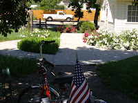
In my Uncle Sam costume, a birthday gift from Cassandra and Scott (my youngest daughter and her husband) I was a popular target for photographs and got lots of shouts from the crowds along the route.


I was unable to ride and get pictures at the same time so all my photos are from before the ride actually started.


I recommend this event for all levels of equipment and rider conditioning.

LINKS:
The Moonlight Classic Website
All my Photos of this event

Saturday, July 11, 2009

Coal Creek Trail - Lafayette, CO Summer 2009

Quick Ride Summary: A short trail with a little of everything – Saturday, July 11th, 2009. The trail surface is Crusher Fine, well packed most of the time, and with some concrete trail surface in areas subject to erosion and for underpasses. The trail is seven miles long. At the east end it starts in Lafayette, CO., passes through Louisville, CO., and ends in Superior, CO. For a Saturday, the trail was not heavily used. The elevation gain over the 7 miles was 344 feet, an average grade of just under one percent.

All of the distances in the write-up are from the East end of the trail at 120th street. As always, you may click on the graphics and pictures to render them full sized and then use your browser’s back arrow to return to the blog. There is also a Links Section at the end of the article with links to all my pictures of this trail and links to other relevant websites.

Within 2 tenths of a mile the trail passed under some railroad tracks and then immediately over the creek. I stopped on the bridge over the creek to take pictures of the creek and darned if a vehicle didn’t go by on the railroad tracks. It was one of those pickup trucks with the special adapters for riding on rails.

At mile .5 the trail enters an area called Raptors Rapture. This is advertised as an area where Hawks, Eagles and other birds of prey nest and live. I looked up the definition of raptor and found that there is some disagreement about specifics, but in essence a raptor is a bird of prey which uses its large talons to capture and sometimes kill its prey. The owl is also considered a raptor.

At mile 1.1 the trail passes the trailhead where I parked my car. There are picnic tables and a restroom.

The Lafayette section of the trail is my favorite. The trail is wide, hard packed, with excellent maintenance, and gives a more rural experience along the creek.

In the Louisville section the trail is softer (more rolling resistance) with good maintenance, often more narrow and passes through neighborhood streets at times.

At mile 2.70 the trail leaves the creek ( to go around an area where right of way along the creek was not available) and climbs a not insignificant hill. At the top of the hill (Mile 3.21) are some amenities, a trail head, and a very nice view of the Rocky Mountains. The trail drops off of the hill and down into Louisville.

Across the street from the trail, at mile 4.21, is the Louisville Community Park. I didn’t go over to look, but it appeared to be quite nice.

At mile 4.5 the trail arrives back at the creek as it enters the Dutch Creek Open Space.

Passing through the open space and along the side of a golf course the trail enters a neighborhood at mile 5.3

At mile 6 the trail goes back to soft surface and at mile 7 it terminates at Grasso Park. This is currently the end of the trail.


LINKS:
All photos of this ride
Boulder County Coal Creek Page

Tuesday, July 07, 2009

Cherry Creek Trail (Lower)

Quick Ride Summary: A Nice Ride – Monday, July 6th, 2009. I started at the confluence of Cherry Creek and the Platte River and rode the trail up-creek for 18.5 miles until I reached the end of the completed and continuous trail; and then back to the car for a total of 37 miles. Sunny and 75 degrees, the trail surface is concrete and plenty wide most of the time. The trail is well maintained and heavily travelled.

All of the distances in this write-up are from where I park the car and unload the trike. It is .17 miles from there to the actual trailhead for the Cherry Creek Trail, so if you have the need to be precise you may elect to subtract .17 miles from my numbers.

As always, you may click on the graphics and pictures to render them full sized and then use your browser’s back arrow to return to the blog. There is also a Links Section at the end of the article with links to all my pictures of this trail and links to other relevant websites.

The Platte River and Cherry Creek are running full due to a very wet spring.


The trail begins with two paths, one on each side of the creek. As you look up-creek the left side is for feet (walkers, joggers, pets, etc). The right side is for wheels (bikes, trikes, skaters and skateboarders).


The creek runs along side of Speer Blvd for part of the way and then is straddled by the road all the way to the Denver Country Club. As you can see, the creek and trail is in a canyon well below street level and continues this way for several miles.


In recent years, Lower Downtown Denver (LODO) has developed into an enclave for young people and thousands of lofts and apartments have replaced the urban blight that once bordered the first mile or so of the trail. This has brought additional trail usage up to the point where it is sometimes unpleasantly busy on weekends. This being Monday and a workday, I only have to contend with several hundred users during my ride.


The other big negative for this trail is the presence of innumerable bums and hobos. They are on the trail, under the bridges, in the parks and anywhere else you care to mention. The authorities pretty much rounded them up and moved them out for the Democrat convention. I don’t know why they can’t make that a permanent solution.


Mile 1.1 brings you to the Denver Center for Performing Arts and also to the Colorado Convention Center. At mile 1.3 the feet and wheels trails combine into one trail and requires one to pay more attention.


At mile 4.5 the trail is bordered by several large black tubes. They run for more than a mile. These are temporary sewage pipes made necessary by local construction. The crews assured me that they will be gone in 7 to 10 days.
The Denver Country Club blocks the trail at mile 3.6. So, the trail rises up out of the canyon and proceeds along the sidewalk of Speer Blvd. in front of the Club for almost two thirds of a mile. This is the most dangerous section of the trail. It is not particularly wide, it is two way, and auto and truck traffic is screaming by sometimes only inches from riders. Evidently the city didn’t feel the need to use eminent domain to keep the trail with the creek.


Next, the trail passes the Cherry Creek Shopping Center. Here, there is an upper and lower trail. The lower trail borders the creek and it was closed due to high water. The upper trail gives you a great view of the shopping center parking garages.


At mile 6 is the City of Glendale Creek Side Park. The park is beautifully maintained and has restrooms, water, electricity and picnic facilities. I invariably stop here for a snack and, if necessary, a health break.


At mile 6.45 the trail passes Four Mile House and Historic Park. I have never stopped there but it appears to display historic Indian and white settler artifacts of early Denver. Then at mile 7 the trail enters Garland Park, another nice park, for about a half mile.


Starting at mile 10 the trail runs along side of a golf course and the trail is as straight as an arrow for 6 tenths of a mile. At the end of the strait the trail intersects with the Highline Canal Trail.


You pass under Dartmouth at mile 11.3 and start climbing. The trail makes a peak then goes back down and under highway 225 and then you start up the face of the Cherry Creek Dam.


I choose to go over the east end (the most difficult climb).
Mile 13.3 is the top of the Dam at elevation 5686ft.


I follow the trail around the east side of the reservoir and ride on to the end of the completed continuous trail, reaching it at mile 18.5.
There is another long completed section of the Regional Cherry Creek Trail near Parker, Colorado. However, reaching it from where I stopped would require several miles of biking on the shoulders of busy streets and I choose not to do that.


Starting back, I elected to go around the west side of the reservoir and stop at the picnic area for another snack, before heading down the west end of the dam and back to the Cherry Creek Trail. It is all downhill from here.

For trail surface, maintenance, amenities and accessibility I give this trail 5 stars.